Refining the Approved Vision
Outline Plan & Land Use Re-designation for 11011 Trans-Canada Highway SW
SHAPE Properties has submitted a land use amendment application to refine the land uses which are currently permitted at 11011 Trans-Canada Highway SW.
| Approved Vision | Refined Vision |
|---|---|
|
Large-scale regional commercial hub with accompanying apartment-style residential |
A residential neighbourhood that features a mix of housing types, in addition to supportive local commercial uses |
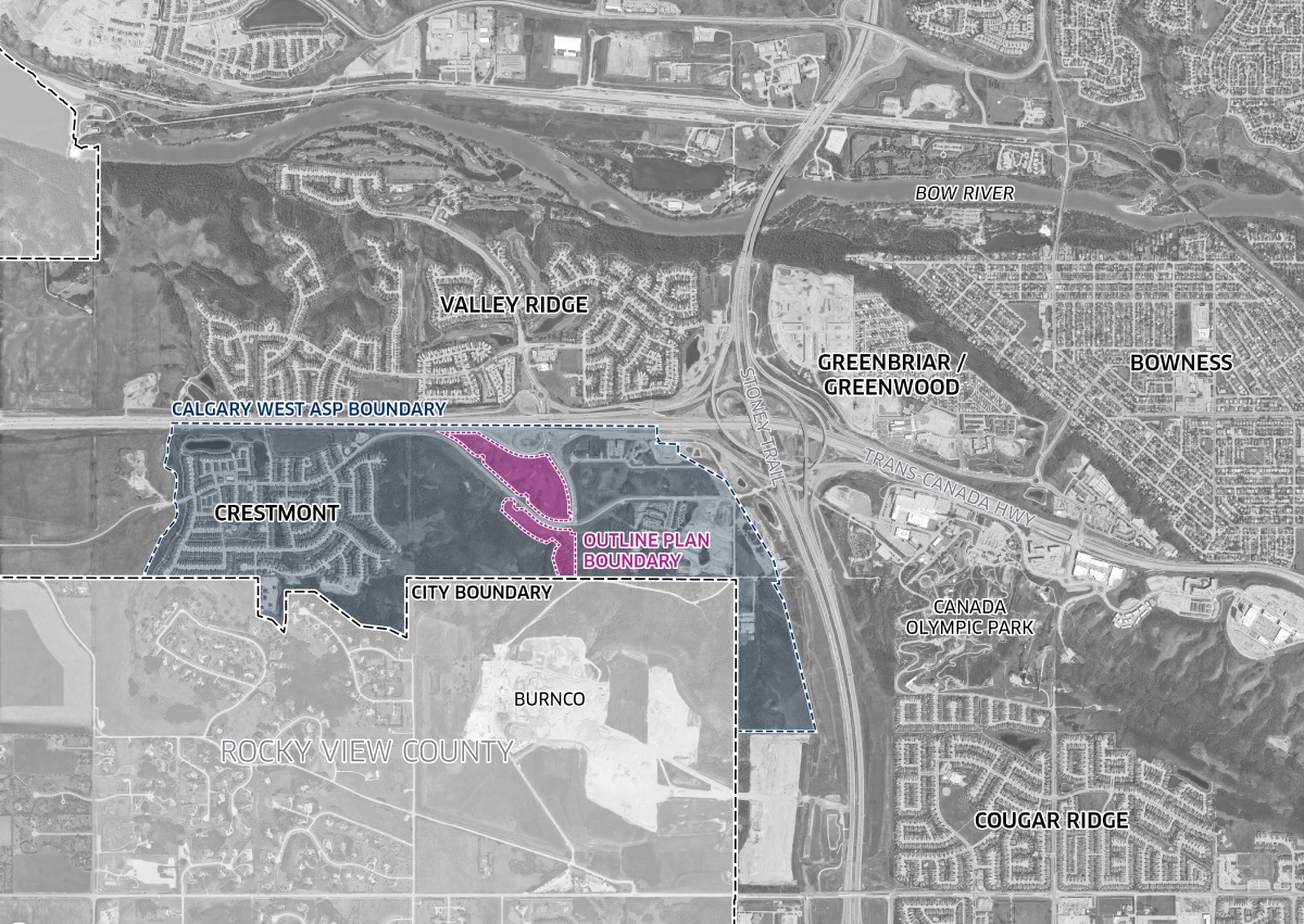
The site falls within Site 1 of the Community Core Area under the Calgary West Area Structure Plan (ASP) — a long-term planning framework for the area, adopted by the City of Calgary through a comprehensive public process. This refined vision continues to work within that framework.
About the Proposal
Since the site was originally approved for development in 2014, the surrounding area has evolved significantly. Our proposal refines the vision for the site to reflect these changes and Calgary’s needs today.
| 2014 | Interim | Today |
|---|---|---|
|
Site approved for development through an Outline Plan and Land Use Redesignation (LOC2011-0079) |
|
Growing need for more homes and housing choice. |
Current vs. Proposed Land Use
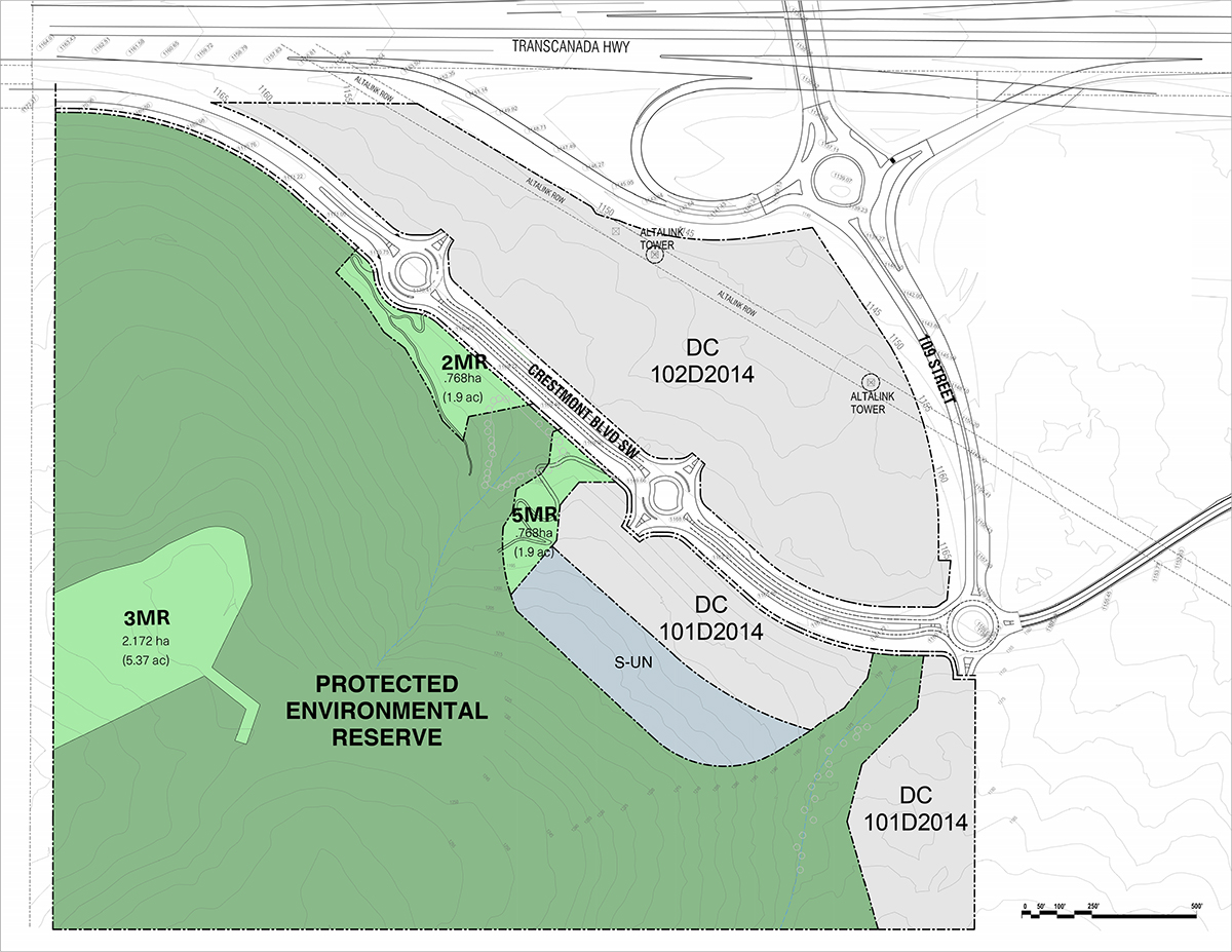
Currently Approved Land Use:
| Land Use | Site Area (Acres) | What is Permitted? | Maximum Density | Maximum Height (m) |
|---|---|---|---|---|
|
Direct Control – 101D2014 |
11.47 |
High Density Low Rise |
Maximum 275 Homes/Ha |
26 |
|
Direct Control – 102D2014 |
25.15 |
Community Commercial |
Maximum 1.75 FAR* |
40 |
|
Total |
36.62 |
|
|
|
Proposed Land Use:
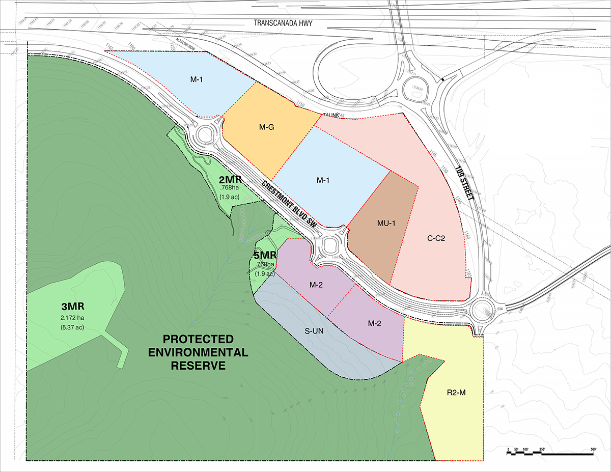
| Land Use | Site Area (Acres) | What is Permitted? | Maximum Density / Expected Density | Maximum Height (m) |
|---|---|---|---|---|
|
R-2M |
6.45 |
Row / Low Density Housing |
Maximum 50 Homes/Ha |
11 |
|
M-2 |
5.02 |
Medium Profile Housing |
No Maximum Density Specified |
16 |
|
M-1 |
8.72 |
Low Profile Housing |
Maximum 148 Homes/Ha |
14 |
|
M-G |
4.42 |
At-Grade Housing |
Maximum 80 Homes/Ha |
13 |
|
MU-1 |
3.16 |
Mixed-Use |
No Maximum Density Specified |
40 |
|
C-C2 |
8.85 |
Community Commercial |
Maximum 2.0 FAR* |
40 |
|
Total |
36.62 |
|
|
|
*FAR (Floor Area Ratio) controls the amount of building floor area permitted relative to the size of the site and does not specify a maximum number of homes.
What This Means
- Maximum height stays the same – Buildings up to 40m are already permitted today. The proposed maximum remains 40m, with lower limits across much of the residential area.
- Residential density remains similar – The existing residential area permits up to 1,277 homes, with additional homes permitted within the 25-acre mixed-use area. The refined proposal anticipates approximately 1,539 homes across the entire site.
- Less commercial development – Today, approximately 25 acres can accommodate commercial development. The refined proposal reduces the amount of land intended for commercial uses by more than half.
- More development certainty – The refined proposal more clearly defines where different housing types, commercial uses and building heights will be located.
What This Means
Currently Approved Land Use
2.875M sf
Maximum Total Density
Proposed Land Use
2.157M sf
Anticipated Total Density*
Total Density Decrease
↓ 25%
Compared with current approved land use
Maximum height stays the same: Buildings up to 40m are already permitted today. The proposed maximum remains 40m, with lower limits across much of the residential area.
Less Commercial Development: Today, approximately 25 acres can accommodate commercial development. The refined proposal reduces the amount of land intended for commercial uses by more than half.
More Development Clarity: The refined proposal more clearly defines where different housing types, commercial uses and building heights will be located.
*Anticipated total density may vary slightly because maximum density for several of the zoning districts is determined by the maximum height not a specific Floor Area Ratio (FAR)
Calgary West Vision
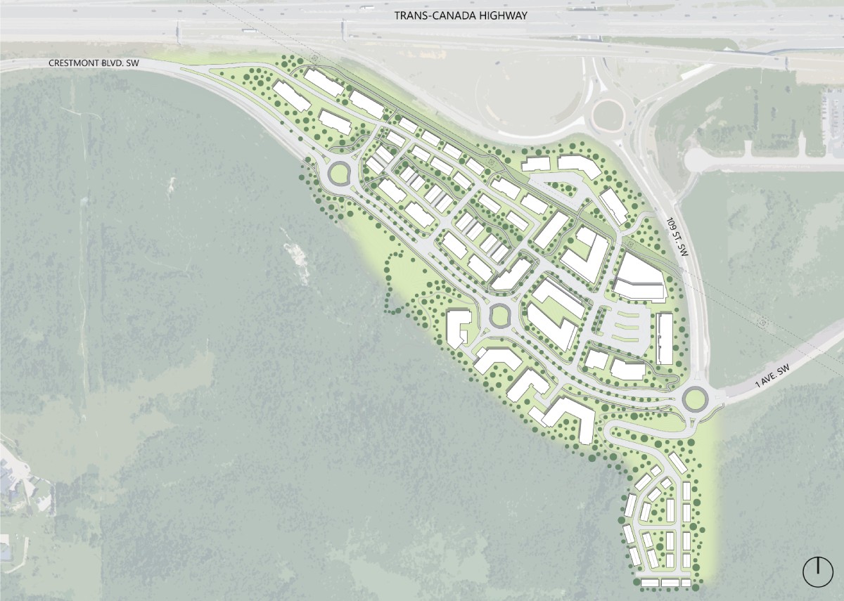
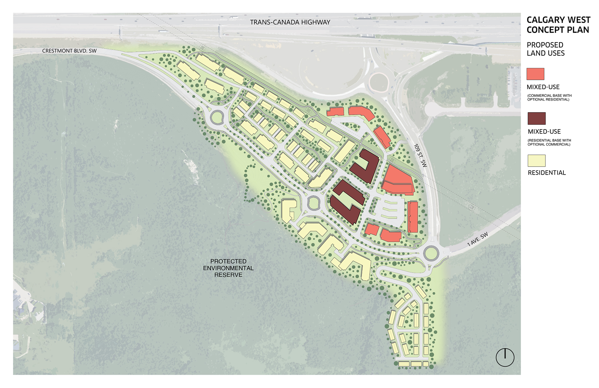
The new vision for the site is for a residential neighbourhood that features a mix of housing types in addition to supportive local commercial uses in a mixed-use format.
Housing for all ages and stages
A full mix of housing types is envisioned — from grade-oriented homes and townhomes to low-rise, mid-rise, and mixed-use apartment buildings up to 10 storeys — supporting residents at every age and stage.
Supportive, local commercial uses
A walkable mixed-use area brings everyday services and amenities within reach, serving the neighbourhood and surrounding community alike.
Connections to nature
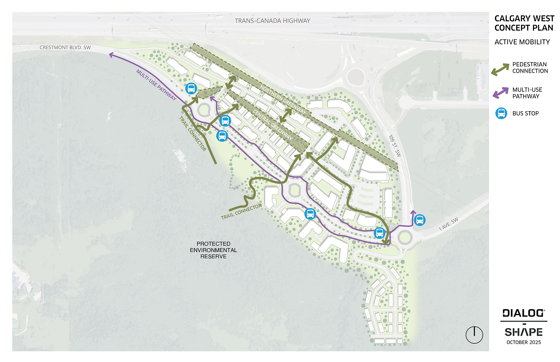
Dedicated pathways connect residents to the protected hillside — a natural amenity for recreation and the environment alike.
Internal green spaces
A Central Greenway and Northern Greenway link the site north to south, forming an extensive green pedestrian network.
Slope-adaptive design
Development works with the site's natural slopes, not against them.
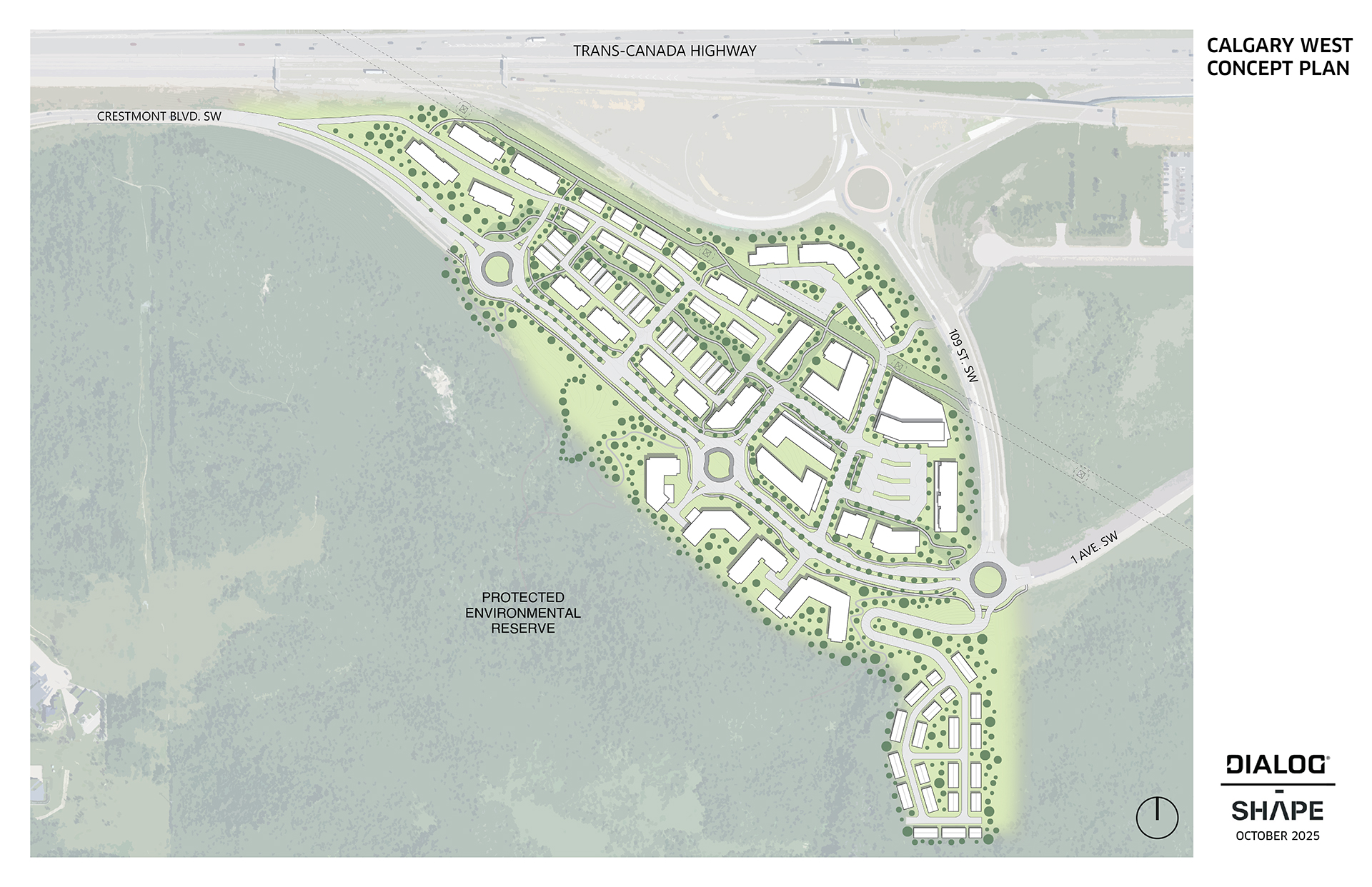
Conceptual Site Plans
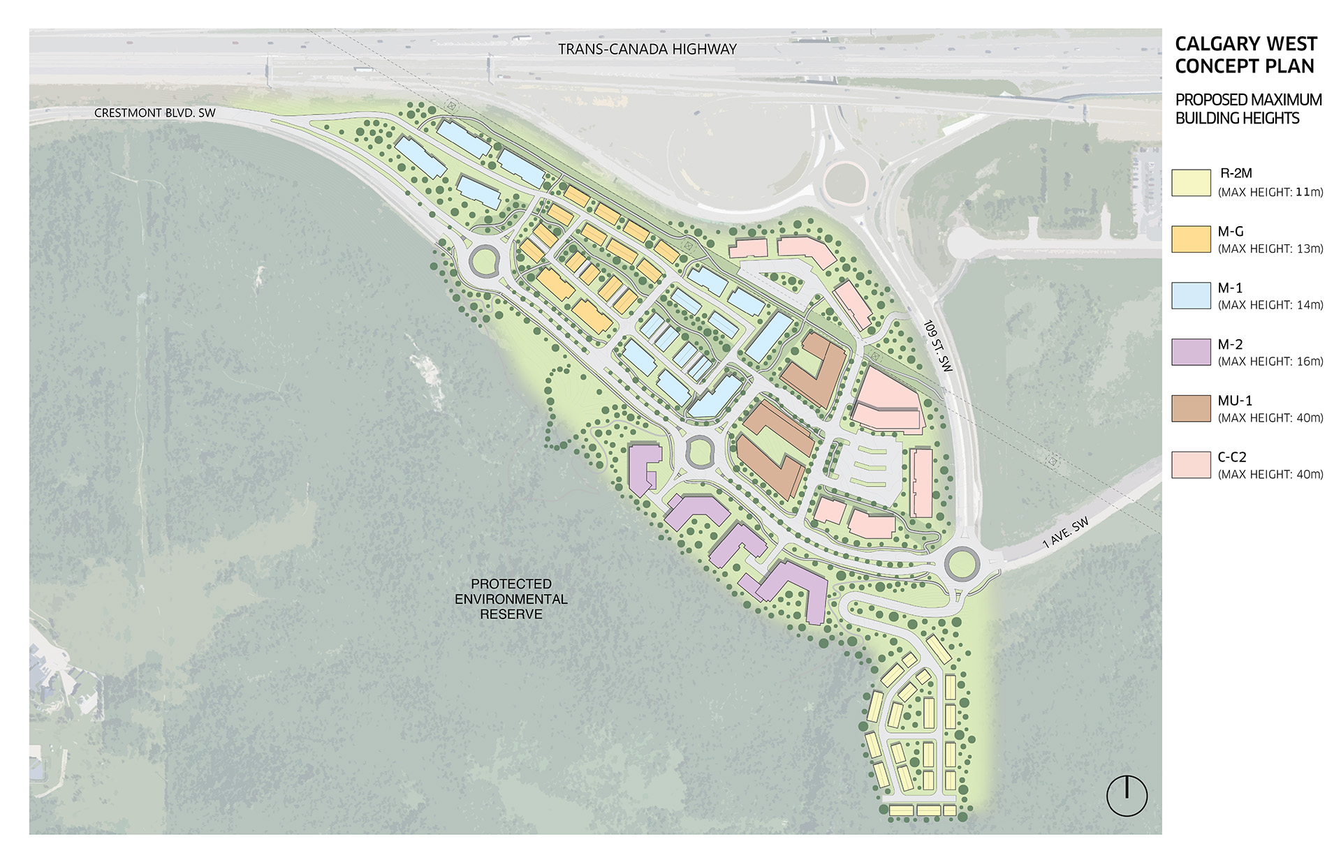
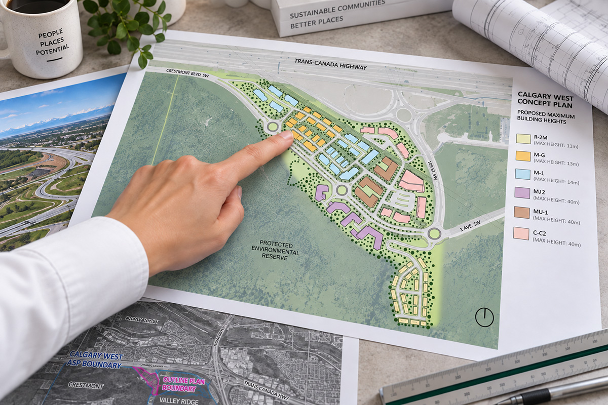
Process & Timeline
Complete: Pre-application review
Completed with The City of Calgary, acknowledging redevelopment potential for the site.
In Progress: Land use redesignation application
Submitted to The City of Calgary.
In Progress: Public engagement period
Info coming soon.
Upcoming: City review & public hearing
Info coming soon.
Upcoming: Council decision
Info coming soon.
- Complete: Pre-application review
- In Progress: Land use redesignation application
- In Progress: Public engagement period
- Upcoming: City review & public hearing
- Upcoming: Council decision
Common questions about the proposal
How will the proposal address offsite impacts of residential density, such as traffic, parking, noise and pollution?
Calgary West has been planned for development for many years, with transportation improvements intended to support growth in the area. An updated Traffic Impact Assessment (TIA) study found that the proposed development can be accommodated with planned improvements, including the roundabout at 109 Street SW and Crestmont Boulevard and a future Highway 1 interchange that would provide another route for area traffic and help reduce traffic on Crestmont Boulevard.
The proposed development also provides new sidewalks and multi-use pathways and identifies five future bus stop locations, helping provide alternatives to driving. Parking, site access, noise and other site-specific impacts will be further evaluated as individual developments proceed through future approvals.
Will the proposed buildings overshadow neighbouring areas, compromise privacy, or change the character of the area?
The site benefits from significant separation from existing residential development through its location, surrounding road network, topography and natural areas, which helps reduce potential privacy and shadow impacts. This application does not approve specific buildings. Building placement, massing, setbacks, landscaping and shadow impacts will be evaluated through future Development Permit applications when detailed designs are available.
What will happen to the trees, green space and wildlife habitat on and around the site?
Why can't this site be developed with single-family homes?
The Calgary West Area Structure Plan identifies this site as a Community Core Area and envisions a broader mix and intensity of development than an exclusively single-family neighbourhood. The proposed land uses respond to that policy direction while allowing for a range of housing forms and densities that can adapt to the site’s unique topography and characteristics. Specific buildings and housing forms will be determined through future development applications.
Does the surrounding infrastructure and public service network have capacity for this development?
Technical studies completed for the application show that the surrounding infrastructure and services can support the proposed development, with targeted improvements made where needed. Water, sanitary sewer and stormwater systems have been reviewed as part of the application. Sanitary sewer flows are expected to be significantly lower than under the previously approved plan, while the approved stormwater management approach can continue to be used. Overall, the technical studies indicate that the proposed development can be supported by the surrounding infrastructure and services. Where improvements are needed, they will be incorporated as the development moves forward. More detailed requirements will continue to be confirmed as individual sites proceed through future development and permitting approvals.
What will the construction impacts be for noise, dust, road closures and emergency access?
The site’s separation from existing residential areas will help reduce direct construction impacts, but some temporary noise, dust and construction traffic can be expected as development occurs. Future construction will be subject to measures for dust, erosion, site access and environmental protection. Specific construction schedules, traffic impacts and access arrangements are not determined through this Land Use Amendment and will be established as individual sites move toward construction.
Contact Us

"(Required)" indicates required fields